Some Petersburg Battefield Pictures
I arrived at the Richmond VA airport late Saturday afternoon. My brother picked me up at the airport and he was anxious to get me home to show me his new boat which we would be launching the next day (on the Appomatox river). Although I didn't attend either UT (or tu)(Univerity of Tennesse or Univerity of Texas (tu)) I still think the boat looks cool.
 More on the boat trip later. Back to the siege of Petersburg.
 I wish I would have taken more pictures like the above. At the Petersburg park, there are lots of these information stations/tablets that briefly describe some of the battlefield details pertaining to the particular location. It can take days to go through everything in the area. The park consists of a small museum and then a very large expanse covering much of the so called eastern front. The eastern front runs roughly north to south along the eastern side of Petersburg. Confederate troops were very well entrenched behind earthen barriers and except for an initial frontal assault that occured at the start of the Petersburg campaign, the confederate troups were able to hold off the well supplied union army. It was only after 9 months and some additional flanking maneuvers by Grant that Petersburg fell. All of Richmond's main supply routes came through Petersburg and when it was over, the insurrection was finished. Within 2 days after Petersburg fell, the confederate capital (Richmond) fell and very shortly thereafter Lee surrendered at Appomatox on April 9. Just 5 days later, Lincoln was assassinated by John Wilkes Booth (a confederate sympathizer) on April 14, 1865.
Canon Barrels Recovered
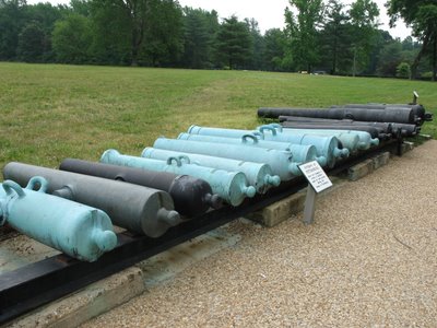 Shown above is a set of cannon barrels that were recovered from the area. Some of them actually have dents (war damage) on them as shown in the following close-up:
 As mentioned above, the battlefield area is quite large. There are several battle stations (battery) that have been preserved to some extent. The picture below is of battery 5 which was constructed originally by the confederacy. In the initial assault on Petersburg, the confederate troops fell back slightly (forming a closer ring around Petersburg) and these earthworks became a union stronghold.
 The picture below is of the information station shown in the above photo from afar.
This picture is taken just inside the fortification.
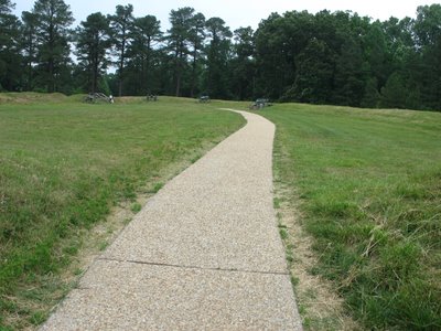 Close-up of a well preserved/restored canon at battery 5.
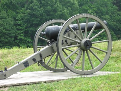 In the pictures above, large berms of dirt with grass growing over them are evident. These were defensive strongholds that troops and artillery personel would hide behind. There are a lot of signs requesting vistors to stay off these so-called "earthworks" as shown below:
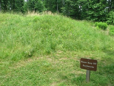 I also stopped at battery 8 of the "Dimmock Line:"
Below is a far away shot of battery 8 where the earthworks are also clearly evident. In fact, the picture above actually points out where the viewer is standing relative to a photo taken at the time. The photo was probably taken by Brady since he appears in the photo at the lower right hand side of the picture within the picture. Brady is the civilian (white hat with brown band) wearing a business like suit. He is largely responsible for many of the existing photos of the civil war -- a whole book could probably be written on his activities during the war. This is not information that was given at the site but I have a 10 volume set called the "photographic history of the civil war" in which there are many photos just like that where Brady posed. I just now realized this as I was looking at the picture in detail!
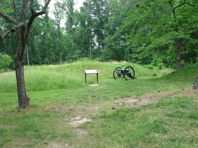
As the day wore on, I started getting lazy (in part because I wasn't quite sure how the photos were coming out) and so I stopped taking pictures of the information tablets. I am not sure what the name is of the fortification below. I don't think this is part of the original earthworks as above but is more of a model of what fortifications were like.
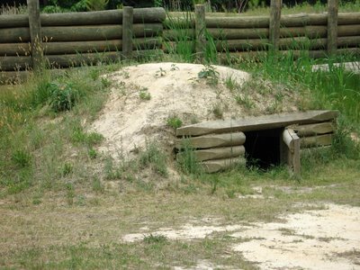
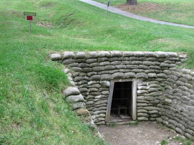
 Below is a picture of what looks to be an underground bunker:
One of the most bizzare events that occurred during the siege is the battle at the crater. There was a certain Union officer (whom I can't remember just now) who had experience with coal mining in Pennsylvania. The union/confederate lines were only separated by 5 to 6 hundred feet and this officer was certain that he could tunnel from the union side to the confederate side and place dynamite beneath confederate defenses. They would explode the dynamite, break a big hole in the confederate line, and rush the union troops through. With a breach in the strong confederate line they would separate the confederate army and easily take Petersburg. This was early on in the siege (June/July 1864).
The entrance to the tunnel is shown below. Notice the sunken ground above and beyond the entrance. These sunken areas continue on up to the actual crater location approximately 500 feet or so away.
 The tunnel was an incredible success but the battle was a complete failure for the union troops. After the explosion, white union troops were flooded into the crater (the remains of which are shown below). Note that the picture is un-impressive although it is somewhat representive as the crater is rather unimpressive as well. I am not sure of the exact size but I recall reading something that said just after the explosion the crater was about 30 feet deep by 170 feet across. Over the years erosion and such has obviously changed its size and shape somewhat.
 The confederate troops quickly mounted a defense picking off union troops within the crater. Then an all black union regiment was sent in and they were also massacred. With regard to the ensuing battle at the crater, there are several passionate monuments to both confederate and union troops and now I wish I would have taken photos of all of them. Below is one such photo with regard to confederate troops.
Also on the crater location is a monument to the black regiments that served and sacrificed.

Sadly, thats all the pictures and story that I have. When walking around these areas I couldn't help but try to imagine what things must have been like for the men fighting here. I was walking literally on the same dirt as they were some 140 years ago.


